Showing posts with label road. Show all posts

Saturday, June 7, 2014

Inca Trail, part 2

Day 3

This was the most beautiful day.  After lunch, we walked along a section of the trail that was really well-preserved, hovered at around 12,500 feet, and took us through cloud forest, along giant valleys, and in view of many huge snow capped peaks.  It was during this portion that one of the porters walked with me and gave me some insight into Quecha culture.  His name was Ephraim Cruz Huaman - the first two names very biblical and the last name very indigenous (it is the Quechua word for an eagle-like bird).  Huaman was his mom's last name.  His wife's last name is Condori.  As you guessed, it means condor.  He pulled some pod-like plants off a vine on the rock face and had me eat some.  They were sour in a good way.  Placados, he called them.  And he took some berries off a plant, which he called macha-macha, and said that if you eat more than one you hallucinate.  Obvi, we did not eat those.  He also taught me some Quecha words which I used that night on the other porters during the goodbye "ceremony."  I'm sad to report they had almost no effect.


Anyway, after the nice scenic portion, we eventually got to another mountain pass with llamas at the top, and proceeded to Phuyupatamarka, a ruin with some excellent examples of Inca ritual baths.  They even had water still flowing through them.  Our understanding of the Incas at this point remained somewhat nebulous.  Our guide and the guide for another pair of tourists in our group were saying some inconsistent things (about whether or not the Incas sacrificed humans, for example) and we are not sure whether anyone knows the answers to the questions we were asking. 


The next stretch was pretty horrific, with somewhere around 2,250 stairs down to our campsite for the night.  I don't want to see another staircase for the rest of the trip.

Day 4

Shockingly, we were woken up at 2:50 am (!), given a sack lunch and led to the final checkpoint, where we sat and waited for two hours for the gates to open.  This was ostensibly to enable us to see the sunrise on Machu Picchu, but honestly, we could have still done so if we had woken up at 5 am like normal, and skipped waiting in line.  We think it was to allow the porters to get home earlier.  Anyway, we were some of the first people of the hundred or so that waited in line that morning.

Once the door opened, the hike to the Sun Gate took about half an hour.  It should have taken twice as long, but we were literally running at times because A) there were more steps and descending staircases and I wanted to be done with them as soon as possible, B) we really wanted to beat the rising sun, and C) a strange competitive spirit took hold among the front of the pack.  A group of Australians behind us began shouting things like, "Let's hunt 'em boys," and "Up and at 'em!" and "We're gaining on 'em."  One of them even blew into an animal horn he was carrying, like he was in hot pursuit of wild game.  We pushed ourselves hard to stay ahead of them, and got to the Sun Gate panting and sweating profusely.


Then there she was.  The ancient citadel, and the best preserved Incan city discovered to date.  For about three hours, we walked between the terraces, temples, houses, and plazas wondering how they built with stone like this and what it was all used for. Our guide led us along the main route, and then we walked around to the other side of the hill behind the citadel and admired the Inca bridge.  Built from stone stacked against the sheer face of a soaring cliff, the Inca bridge was almost more impressive to me than the city, because it highlighted in one clear line how complex the engineering was.


We walked down to the tourist haven of Aguas Calientes and had a soak in the weirdly murky but relaxing hot springs.  This was just the antidote we needed for our aching calves, knees, and thighs.  We had lunch and dinner with Harriet and Franky, our new friends from the UK, before getting on the train back to Ollantaytambo, and then the bus to Cuzco.

I would recommend the Inca Trail to anyone who likes guided package tours and exercise and photography, and is willing to pay top dollar.  I would recommend it less to someone who is trying to understand the Incas in depth, or to anyone who wants to do day hikes like the ones we have in the US national parks.  This trail was very rough-hewn and steep and uncomfortable, and the information on the Incas is not very site-dependant.  Machu Picchu was the single most expensive piece of our trip, and while it may not have been completely worth the cost, it was definitely worth the time and effort.

Inca Trail, part 1

Day 1


At kilometer 82 where we started, the Inca Trail begins as a footpath that was built and maintained in the 1980s.  The actual path built by the Incas is now buried underneath a railroad which runs to Machu Picchu.  The scenery is spectacular, with glaciers poking out behind mountains carpeted in green - a huge difference from the dry, completely barren mountains near the coast.  Our first day did not really follow the path, though we witnessed where it would go through the Urubamba river valley.  Our guide Ramiro told us that we would see parts of the original trail the next day, and that it was 60% "new trail" at this point.


This new trail was very smooth dust and gravel and allowed for an easy day of walking, with several ruins along the way.  My favorite was Llaqtapata, a paw-shaped settlement set in a dramatic valley.  The ruins were very green and, Josh noted, shockingly orderly.  It is obvious that Peru puts a lot into maintaining this area.  It was a bit difficult to imagine a day in the life of the people who lived here, but we can see that they had lots of decorative niches in their house, and no windows.  It was also obvious to see that they had intense city planning and really liked landscaping!  I was not as moved as I had been with some other ruins on this trip, where you could see individual etchings or inscriptions, and imagine some ancient story behind it.  But they were beautiful, almost otherworldly in their smooth, terraced shapeliness.


Speaking of otherworldly, Ramiro told us about a theory that the Incas had uncovered the secret to teleportation.  We both gave him quizzical looks.  He said, "Who knows?" and went on as if he might actually believe it.  But really?  We figure, if the Incas had teleportation, why would they have built this trail?

Day 2


This day is known as the challenge day. We started at 9,800 feet, climbed up to the Warmi Wañusca pass at 13,800 feet, and descended down to our camp at 11,800 feet, all within 6 hours.  It was definitely painful and slow going.  The path was a continuous steep slope.  And while we did see the original trail today, it was not exactly a relief.  The Inca had built steep stone stairs that made the slope even harder to climb, in my opinion.  We had to take big steps that challenged the limits of our glutes.  Meanwhile, the porters (local men hired by the trekking companies) were carrying gigantic backpacks (at least four times as big as ours) and passing us constantly.  Some were like sixty years old!  The climb was a humbling experience whose details are, sadly, hard to remember due to the fatigue.


There were no ruins along the way, other than remnants of the trail.  While relaxing at the camp, we shared pictures from our entire world trip with the porters.  They laughed at the pictures of women carrying baskets on their head in Africa, and they did not know who Nelson Mandela was.  I did not get much farther than that because lunch was shortly served - lomo saltado, barley soup, rice, and salad with cheese.  (The food on the trail was always really good!)  We relaxed all afternoon, but the German couple in our group did not make it down to camp until 4:30pm.  We think the altitude really got to them.  Fortunately they brought some meds that they shared with Josh, who also had altitude symptoms that evening.  This did not stop him from getting out of the tent in the middle of the night to admire the stars (and use the toilet...) which in his words were wondrous.  Altitude has its benefits!

Sunday, April 13, 2014

Where All Roads Lead

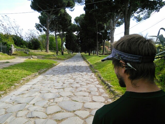
Ancient road number six: Via Appia (the Appian Way).


Connecting ancient Rome to the South of Italy.  I always thought the road led to "Appia." But there is no such thing.  No, it ends at Brandisi.  Funny how we'd heard of the road, but not known where it led.  Or, excuse me, where it came from.  Because as you know, all roads lead to one place.


With all the roads leading here, no wonder it is so crowded!  Josh and I felt like we had more space in Tokyo.  Rome's subway is the most packed transit we have used anywhere.  The lines to get into museums and catacombs and churches are monstrous.  The piazzas are choked with hawkers, and buses regularly caught in traffic.

It is so easy in a city like this to fall into the trap of seeing too much and doing nothing at all.  On Saturday, we tried to pack in the Vatican Museum, the Basilica of Saint Peter (photo below), and Trastevere.  We spent way more time waiting in line than anything else.  It works much better just to breathe, see a fraction of the things that are available, and spend more time soaking up the city.


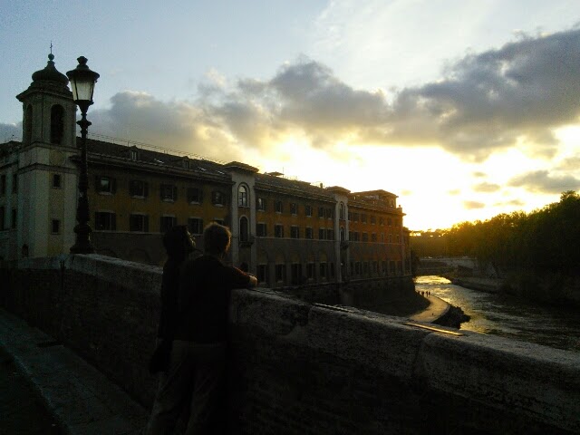
When you do that, you begin to appreciate all the LIFE that is happening here.  Wisteria vines in full bloom, trained over decades to grow in the shape of pergolas and railings.  Chiseled marble and travertine everywhere, pieces of ancient city walls incorporated into the sides of houses and buildings, musicians playing the didgeridoo on old pedestrian bridges over the Tiber, small bookshops selling pocket Greek tragedies, and dramatic public quarrels (we've witnessed two so far, so brazen they almost felt staged).


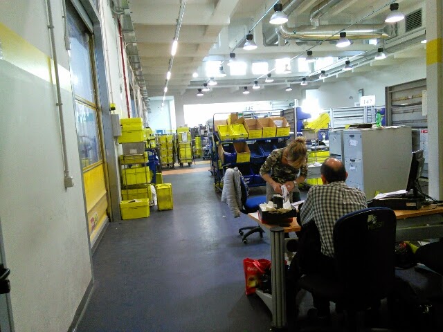
Try as you might, however, you get sucked back into waiting in lines and dealing with bureaucracy.  Getting gelato this afternoon, we had to take a number!  And don't even get me started with the Post Office here, how they deflect all questions and send you round and round until you end up at the building where packages go to die.


I think we have learned a little about Rome, and more about ourselves.  Hopefully, Cairo in a few days won't be too overwhelming!


Tuesday, March 18, 2014

Likya Yolu

Ancient road number 5: the Lycian Way (Likya Yolu in Turkish).  So to be honest, this is not really a road and it is not really ancient.  It is a 510 km collection of footpaths, major streets, mountain trails, beach walks and so on, and it goes across some ancient sites along a southern peninsula in Turkey that used to be the home of the Lycians.

Ruins are pretty disheveled here but the coastal scenery is gorgeous.  We walked one stretch from the coast to a mountain village (used to be a lake but was apparently drained by the Romans).  A goatherd along the way made excellent hissing and screaming noises to clear the goats off the path for us.


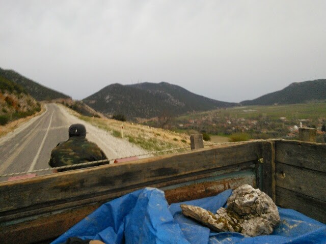
When we got to the top of this trail, we were in a village where the only place to stay charged 90 euro per night!  It was a fancy B&B in a really small and not exactly prosperous hill town.  I was kind of embarrassed that the owner would charge that much.  To get out of there, we hitchhiked on the back of a tractor (FUN!) and landed a comfortable room for 50 lira (a fifth of the price) back on the coast.


I think the best part of the actual ancient sites here are the rock cut tombs.  In Myra (now Demre) some have Lycian inscriptions (looks a bit like Greek, but it's not!) and you can climb up into them, as long as you don't mind being barked at by village dogs.  Fortunately for us, we somehow acquired a stray mutt on the walk from the bus station.  He became our loyal friend and defender and visited all the sites with us - about 8km roundtrip!  With him by our side, other dogs seemed far less menacing.


We named him Nikolai by the way.  Why Nikolai?  Because Myra was the bishopric of Saint Nick!  This town definitely claims him as their own, with a Baba Noel museum (the Cathedral of Saint Nicholas) and the market of Santa kitsch.  It was pretty bizarrely excellent to see vendors selling icons of Saint Nicholas for Russian tourists.  And weirder still, the town hall has Santa's jolly face as part of its seal.  Thinking of him as Mediterranean makes me realize how little I know of Santa's actual life.  It definitely messes with the traditional North European-American reindeer and elves thing.


Day after tomorrow, we leave the Lycian Way for Istanbul and further into the Balkans!

Monday, January 13, 2014

That was lucky

Ancient road number 2: the Nakasendo Highway.  Like the Tokaido Highway from our last post, this was an important road linking Tokyo and Kyoto back in the days when Tokyo was called Edo.  Unlike the Tokaido Highway, the Nakasendo Highway is a fair bit north in the area known as the Japan Alps.  Thus snowy.   The trail was treacherously icy at points.  One clever old man on the trail had wrapped twine around his shoes to increase traction.  We just repeatedly wiped out for 8 kilometers.  But it felt awesome to consider that we were walking the path that feudal Japanese lords would follow to visit the capital from the provinces.


The story of our getting here is yet another testament to how gracious Japanese people can be.  We arrived in the sleepy mountain outpost of Tsumago by bus at 6pm without a place to stay.  The sun had set and no signs were in English.  It was freezing, and there would be no more buses until the next morning.  From the narrow street, every house, restaurant, and potential hotel had the same dormant exterior.  We briefly considered sleeping under an awning somewhere.  Fortunately fate led us past a man walking his shiba inu at night and smelling vaguely of sake.  It took a while with our limited knowledge of each other's languages, but he made some phone calls for us and found a lady willing to lodge us at her Ryokan (old style inn).  Her cedar-wood onsen (hot tub) was incredibly relaxing and her breakfast was delightful: salmon, egg, miso-rice wraps, pickles and sweet beans and, most bizarrely "sticky potatoes."  Imagine raw potato hash embedded in a spittle-like foam.  If you ever come to Tsumago, look her up:  it is called the Daikichi Inn.


Tsumago is about halfway between Nagoya and Matsumoto, the latter being an awesome place to find yourself randomly on the second Sunday in January.  We had no idea when we arrived that it would be the weekend of the Candy Festival.  But the candy was nowhere near as impressive as the teams of people carrying shrines on their shoulders and bouncing around the town.  There was squid on a stick and Taiko drumming and then it all culminated in an epic tug of war contest to commemorate an ancient feud between two local warlords.  It was pretty sweet.  (har har)

Saturday, January 11, 2014

Fuji-san

Ancient road number one: the Tokaido Highway.  A cedar-lined path on the old road to Tokyo during the Edo period.  Now it links two small towns on the banks of Lake Ashinoko, itself a volcanic crater sitting at 950 meters above sea level, in the shadow of Mt. Fuji.

I hadn't realized how absolutely and utterly iconic Mt. Fuji is.  He is such an icon that all you need to represent him in print is a trapezoid, top half white and bottom half blue.  Apparently shrouded in clouds most of the time, he made a full appearance for us this wintry morning.  It was hard not catch the infectious Japanese giddiness at seeing him. 

He hasn't erupted since 1740 something but he's still got excellent underground activity bubbling.  We smelled the highly sulfurous gases coming from a bubbling source at the popular viewing spot of Owakudani.  And then we ate five boiled eggs cooked in that very same bubbling source.  The shells turned black in the water.  We cracked them, peeled them, and ate them with salt while staring at the (lonely/noble/humongous/secretive) icon that would soon be cloaked in clouds again.